Should you fly today?
Minimums decodes METARs (aviation weather reports) into plain English, checks conditions against your personal minimums, and gives you an instant Go/No-Go before you drive to the airport.
Minimums decodes METARs (aviation weather reports) into plain English, checks conditions against your personal minimums, and gives you an instant Go/No-Go before you drive to the airport.
Built by a pilot, for pilots. Every feature designed to make your preflight faster and more confident.
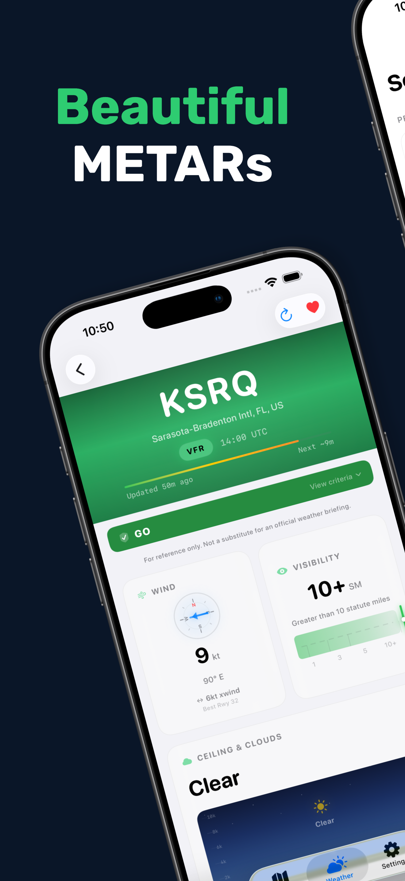
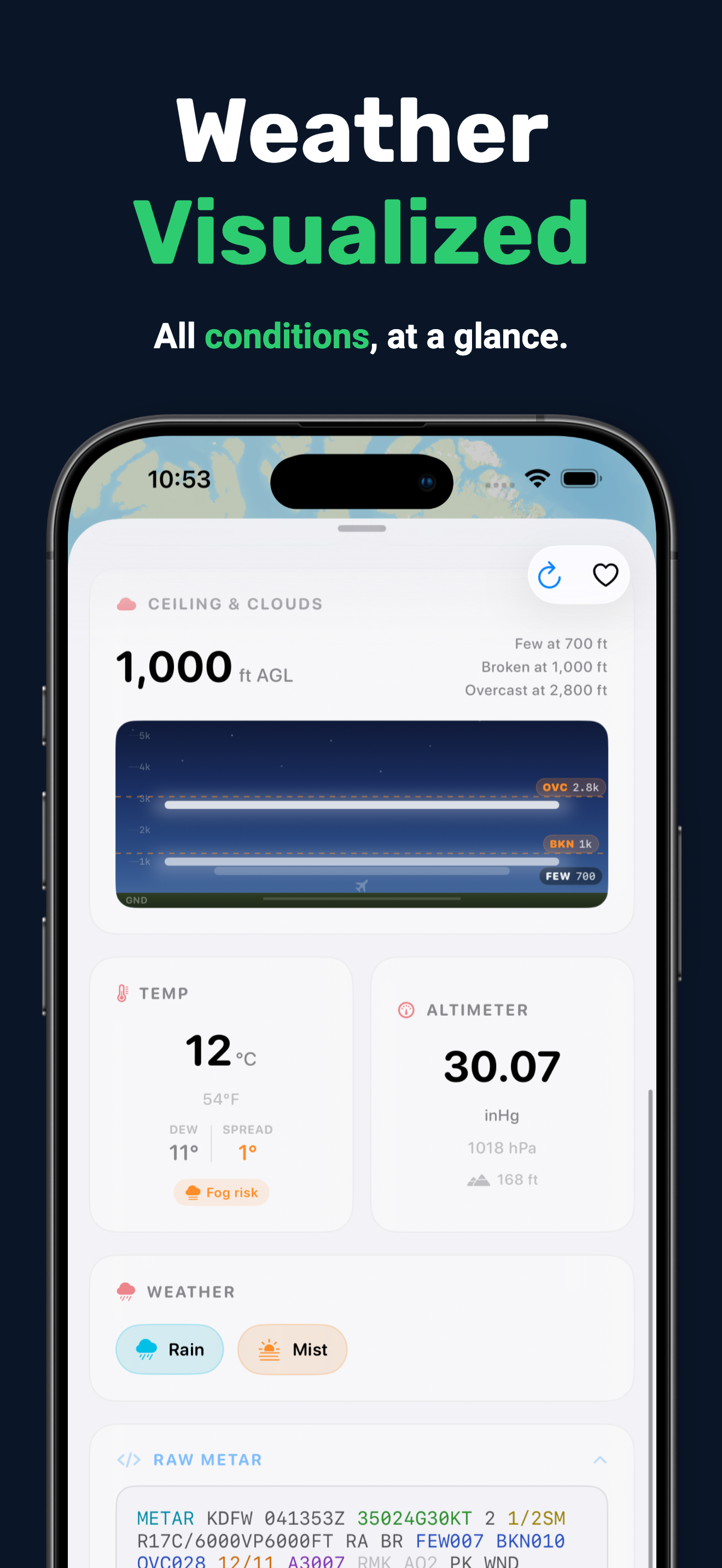
Wind compass, ceiling diagram, visibility bar, temperature, altimeter, and density altitude. Every METAR rendered as a visual card you can read at a glance. Tap any field to learn what it means in plain English.
Every TAF period painted by flight category with a tappable timeline ribbon and syntax-highlighted raw text that matches the visual language of the period cards.
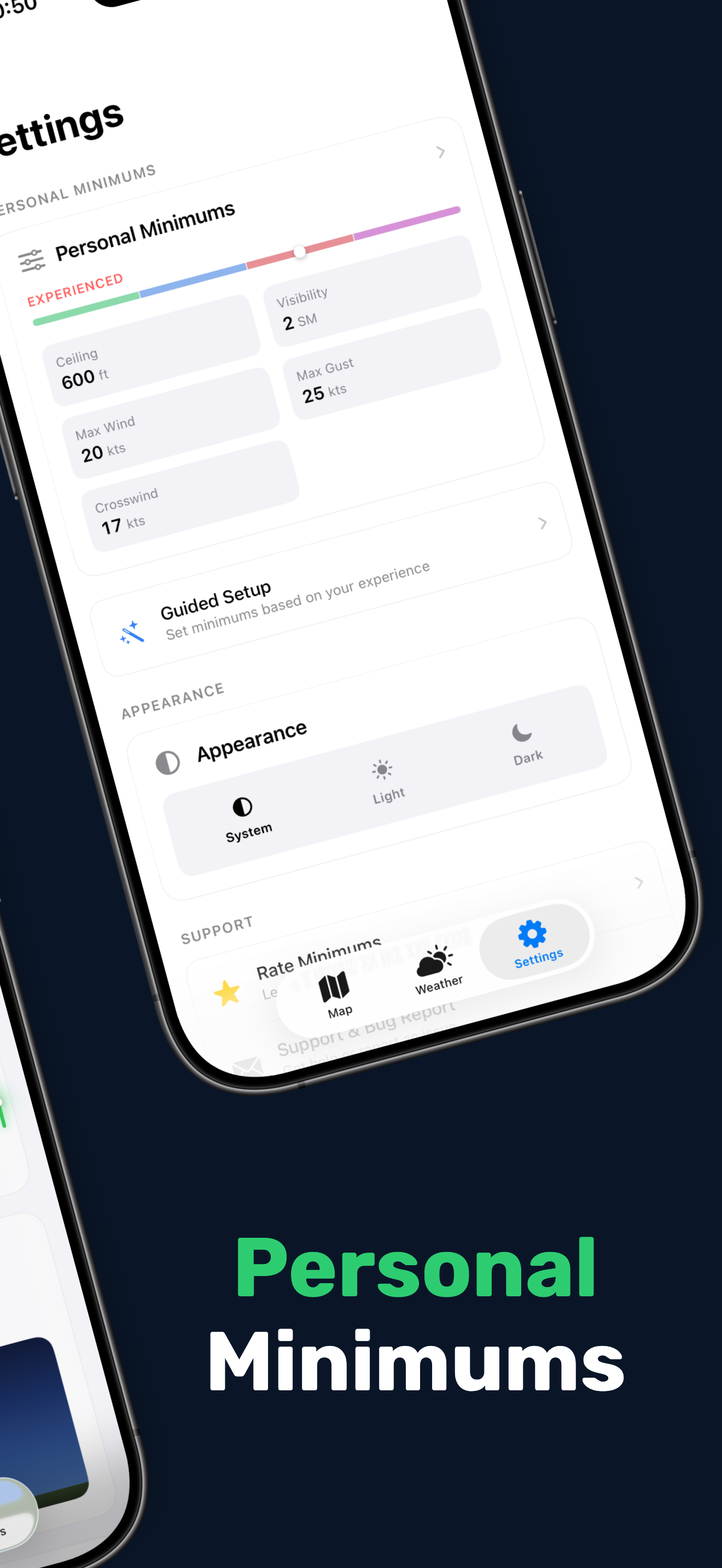
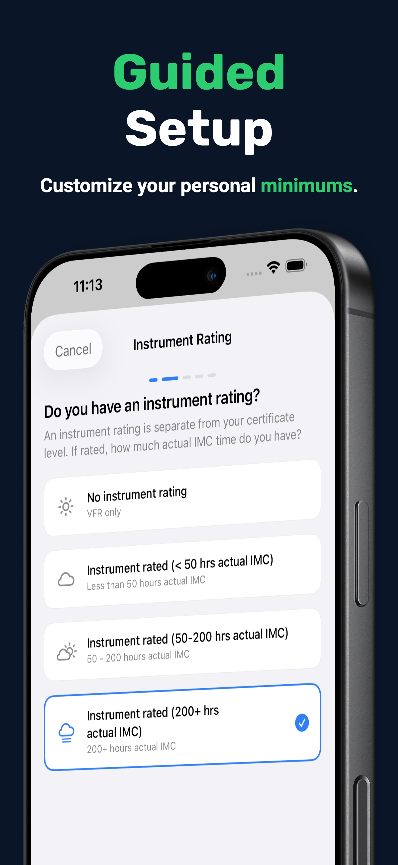
Guided onboarding tailors ceiling, visibility, wind, gust, and crosswind limits to your certificate and experience.
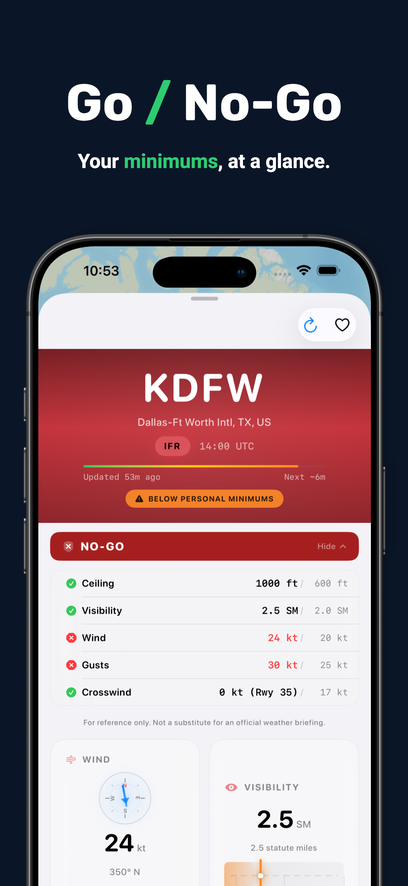
Ceiling, visibility, wind, gust, and crosswind checked against your personal minimums.
Bundled runway data for 538 airports, with crosswind and headwind components built into every minimums check.
Real-time DA with an amber warning when it exceeds field elevation by 1,500 ft.
Export any METAR as a stunning shareable image. Long-press favorites for quick actions. Pull-to-refresh, rich haptics, and a direct link to the official report on aviationweather.gov.
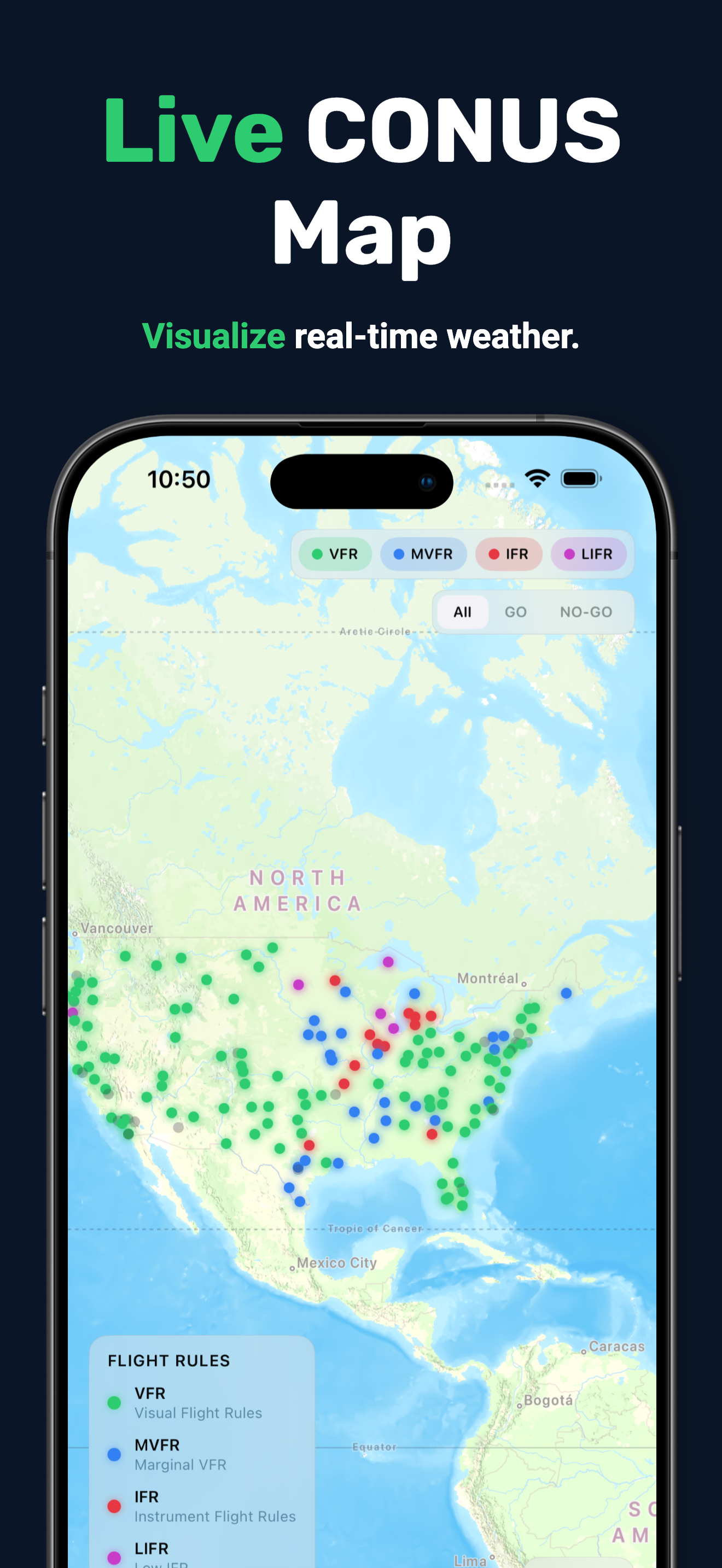
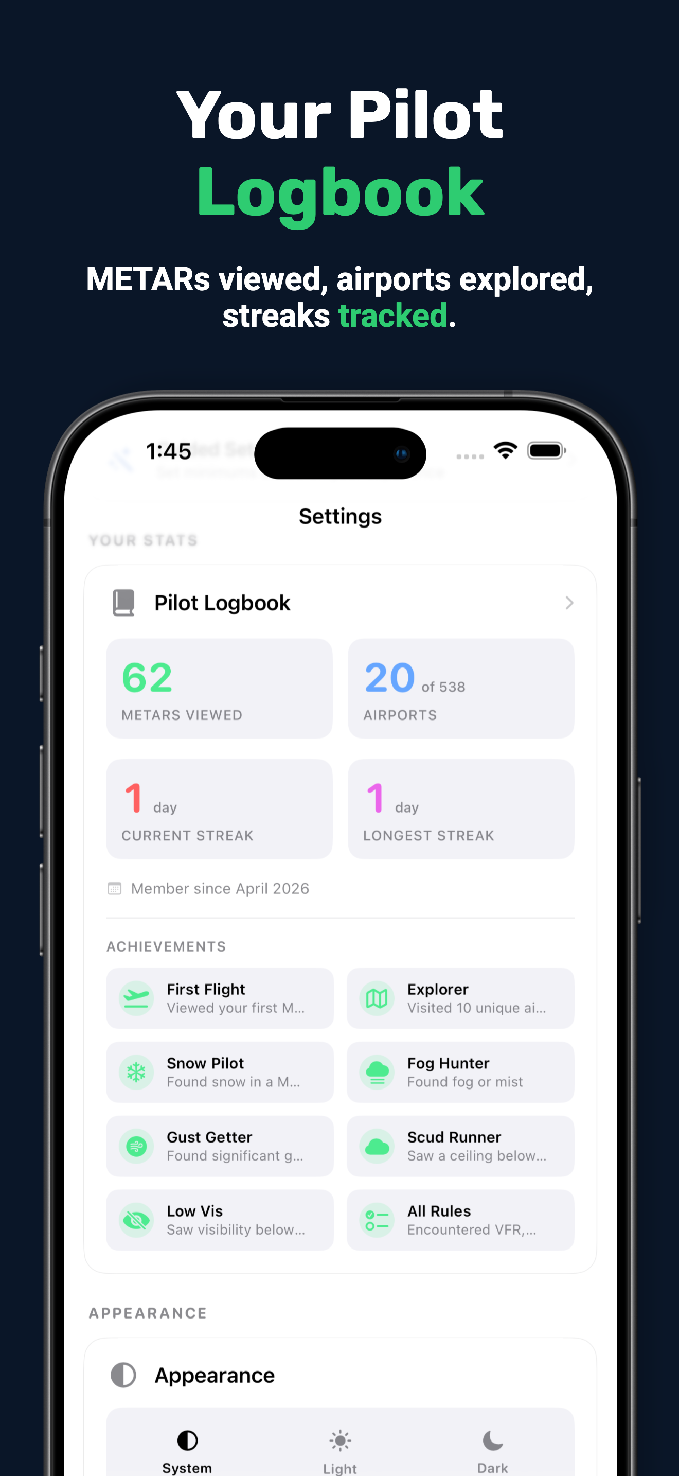
The closest reporting airports, sorted by distance with live conditions. A lightweight logbook quietly tallies the airports you've checked in the background.
Designed to be beautiful, fast, and informative.
Find airports by ICAO code, city name, or airport name. Your nearby airports appear automatically.
Decoded weather with wind, visibility, ceiling, and temperature. Beautiful visualizations with live freshness tracking.
Your personal minimums checked instantly. A clear Go or No-Go to support your preflight decision.
Download Minimums on the App Store.
Available for iPhone and iPad